Wednesday, June 12, 2013

Mohonk Moutain House

This past weekend I visited upstate New York with my mom for the weekend.  The purpose of the trip was to attend Country Living Magazine's craft fair in Rhinebeck.  After the first day I had seen it all so the next day I took the rental car and headed over to Mohonk Mountain House in New Paltz.  First of all, it is very removed from everything on its own mountain.  It is a large sprawling hotel built in a 19th century Victorian castle.  Because of their exclusive reputation, it actually costs $25 just to get on to the property as a day hiker.

Yes, my mouth fell open too.

However, let me say, that I think it is worth it.  While you are not allowed to enter any of the buildings (what are we, peasants??) you have full access to the grounds for hiking.  This is certainly cheaper than paying for a $450/night hotel room or a $60 lunch, which are the other two ways to get onto the property.  When I arrived, I had to park at the bottom of the mountain then had the option of taking a shuttle 1.5 miles up to the main hotel or hiking up.  I decided to take the shuttle up and hike back to my car later.

Main Hotel on Mohonk Lake

There are many trails on the property, most of them being old, flat carriage roads.  Most of the trails begin at the main hotel.  I had read about a 45 minute rock scramble on the property called the Labyrinth that will eventually take you to Sky Top which is the highest point at Mohonk.  I was excited to attempt this, but because it had been raining and I wasn't wearing the proper shoes, I had to abandon this plan after 5 minutes and a near fall.

I decided to hike up the semi-steep path to Sky Top where there is also an observation tower.  The views it supplies are incredible and allows you to see into 6 different states.


I headed back down to hike the flat trail around the lake then headed back down to my car.  None of the trails at Mohonk are remotely difficult, except for the rock scrambles.  Overall, I'd say the views alone are worth the $25 entrance fee and I will probably return when I go up there next year.

Sunday, June 2, 2013

Big Cypress: Tarpon Lake

Yesterday I had the opportunity to join the local Florida Trail Association chapter on a hike to Tarpon Lake within Big Cypress National Preserve for National Trails Day.  There isn't an actual trail that goes there, so the hike leader had previously bushwhacked his way into the Everglades and had saved his route in his GPS.  About 20 of us met at a new rest stop at Mile Marker 52 on Alligator Alley/I-75.  There are no facilities at this new recreation area, just parking and a boat ramp.  We had been warned previously that this was going to be a wet hike.  We headed into the cypress trees and eventually came to an old ATV trail.  ATVs were previously allowed in this section of Big Cypress but the environmentalists won out recently so they are no longer allowed.


We followed this wet ATV trail in water up to our shins for awhile before heading off onto another old, unmarked trail.  Along the way we saw bear, deer, raccoon, bobcat, alligator, and various bird tracks.

Bobcat tracks

Walking through deep water in the Everglades is like no other experience on Earth.  I highly suggest trying it! On these wet trails you will see the most amazing flora!


After about 2-2.5 miles, we arrived at Tarpon Lake.  It is one of the few deep lakes in the Everglades, meaning about 50-60 feet deep.


A few of us headed further into the swamp to look for orchids growing on trees, specifically the ghost orchid which blooms around this time of year.  Sadly, we didn't find any.


On our way back to the parking lot, our leader decided to take us a different way and we ended up having to walk through Sawgrass higher than our heads.  There's a reason it's called sawgrass and our bleeding wounds proved it lived up to its name.


Overall, it was a really great hike that I would love to do again in the future, minus the sawgrass.


Monday, May 20, 2013

Paynes Prairie & Devil's Millhopper

Recently, I was up in Gainesville visiting my best friend, Auz.  This is a guest post from her about some of our hikes up there:
Paynes Prairie became the first state preserve in Florida in 1971, and since has been designated as a National Landmark.  

More than 20 distinct biological communities thrive in this national preserve - you can even see wild bison and horses from designated observation decks!  There is a Visitor Center (which we did not go to) that provides audio-visual programs that explain the area's natural and cultural history. 
One of the most popular trails, Gainesville-Hawthorne State Trail
is a 16 mile long, paved trail that snakes through Gainesville.   


 We had a great time trouncing through Paynes.  We even saw some wildlife! 


The hobby herpatologist wasn't paying attention and Megan almost stepped on an exquisite adult coral snake.

I didn't have my snake stick, so I couldn't get a very good picture.  I can only blame myself!
There was a good amount of canopy cover on the trail that we walked.  It kept it from being too terribly hot.
We were out for a couple of hours and it was very overcast the entire time.  The sky was threatening us with rain, but that didn't deter Megan and I from continuing our adventure.  We stumbled upon a gorgeous observation bench.  This was my favorite part of the day.  We took a seat and slowly ate our Publix subs and took in the sights.  


Devil's Millhopper


The second part of the day was a short jaunt over to a set of lushly landscaped stairs.  It's the second cousin of Tallulah Gorge State Park 1099 steps down.  This pristine limestone 120 feet deep sinkhole has been visited by the curious since the early 1800s.  There is a Visitor Center with clean bathrooms and pets are allowed!  We saw a lot of people running the stairs.  It is definitely a beautiful place for a morning workout.  At the end of each flight, there is a information plaque regarding the sinkhole.  It's a nice way to catch your breath and learn something new at the same time.   


Devil's Millhopper Descent
 
Megan is looking ethereal while reading one of the information plaques

Path around the "Millhopper"

Monday, May 6, 2013

Cedar Key

This really isn't hiking related but yesterday, Auz and I went to Cedar Key, FL.  I had been wanting to go here for awhile and when I found out how close it was to Gainesville, I insisted!  It is an old town by Florida standards.  It dates back to the mid 1800s when it had an important role as an army base, port, shipping base, and pencil factory supplier.  Cedar Key used to be located on nearby Atsena Otie Key, which was harvested for its "cedar" slats (likely it was juniper) to send to northern pencil factories.  Unfortunately, when Henry Plant built his railroad to Tampa they lost their importance as a shipping port and all their business, causing a decline in the area.  In September of 1846, a hurricane destroyed Cedar/Atsena Otie Key and it became abandoned.  After the hurricane, the remaining residents moved to modern day Cedar Key to rebuild their town.  Only one building remained standing on Atsena Otie, and it was later moved to Cedar Key.

We started our day in Cedar Key at their Historical Society where we learned a lot about the history of the islands and were able to view some very neat historical artifacts.  We then walked around the town and checked out the shops and art galleries until we were ready for lunch.  We randomly chose Seabreeze Restaurant based on their menu and were not disappointed.  We each had a beer and a Cedar Key salad which is lettuce, peaches, tropical fruit, candied pecans, and a scoop of pistachio ice cream!  It sounds like a crazy concoction that a pregnant lady would eat but it is surprisingly good!

Artifacts at museum


After lunch, we paid a guy to take us on a boat to Atsena Otie Key to explore the ruins on the former town.  There is a main dock on the island and a trail that goes through the middle of it.  We checked out the cemetery, building remains, and the beautiful beach before calling for our return boat ride.  On the way back, the man brought his two young daughters.  We ended up seeing some dolphins near the boat and followed them for 30 minutes.  They were swimming so close to the boat you could almost reach out and touch them!


We ended our trip at Low Key Hideaway which is a hotel and tiki bar on the beach that was recommended by some locals.  We drank some tequila and enjoyed the sunset before heading back to Gainesville (warning: they only accept cash!).  We had a fantastic day in Cedar Key and definitely want to return and stay at one of the cabanas at Low Key Hideaway!

Funny stools at the bar

Relaxing by the water

View from Low Key Hideaway


Wednesday, January 30, 2013

Florida Trail: Oasis Visitor Center to Loop Road

This past weekend I finally convinced my dad to do a wet hike on the Florida Trail with me.  When I first presented the idea in the past he said no way because hiking miles and miles through water did not sound like his idea of a good time.  I chose the Southern terminus of the Florida Trail to start with.  Early Saturday morning we drove both of our cars down Tamiami Trail to Loop Road in the Everglades.  On the way down Tamiami we saw more birds than I could count along the canal.  We left my car down there and drove his up to the Oasis Visitor Center on Tamiami Trail.  On the drive back up we saw a few hunters participating in Florida Fish & Wildlife's Python Challenge.  As I'm sure you've heard, the Florida Everglades is having a bit of a problem with former pet Burmese Pythons that were let loose and have grown to mammoth proportions.  They have no predators of their own and have been eating all the wildlife, including deer and alligators!

We checked in with the ranger station and got a permit (they like to know who is out there in case you get lost/go missing).  The ranger warned us to look out for cottonmouths/water moccasins which are pretty prevalent on the trail.  On the way to the trail we saw a bunch of tourists photographing a small 8 foot gator, while on the other side of the road this huge mama sat unnoticed!


Unfortunately, there is almost no signage for Southbound hikers on the Florida Trail and we initially set off on a shorter trail designated for tour groups.  We turned around and had to ask a ranger to point us in the right way.  If you are doing this hike, head west on Tamiami Trail and keep an eye out for a very narrow path with an orange blaze on a skinny tree (we walked right by it a couple times).  Once we were on the trail the blazes were prevalent and we had no issues with getting lost.  Even though it is dry season, the trail is still very muddy and wet.

 Florida Trail near Oasis Visitor Center

You might ask, "What shoes do you wear on a wet hike?".  We pondered this ourselves for a few days before.  We figured that if we wore sneakers or hiking boots they would just turn into heavy bricks on our feet.  Crocs didn't seem like a good alternative either.  In the end, we settled on wearing water shoes (the ones with mesh uppers and rubber bottoms).  We knew it would be a gamble and weren't sure if they would hold up but they ended up being the perfect choice.

The first mile or so was through thick, shoe-sucking mud.  After that it was almost a relief to get into the shin deep, cold water.  I know this sounds like a terrible hiking idea, but it was really enjoyable.  The temprature was about 70-75 degrees and the water felt wonderful.  It was also crystal clear so you could easily see what you were stepping on.  This continued on for another few miles as the cypress trees thickened and we saw more and more Bromeliads on the trees.  Here is where we ran into 3 Cottonmouths all within a 1/2 mile distance.  They were prominently sitting on the trail, not easily missed.  We bushwhacked our way around them and gave them a wide berth.

Cottonmouth


Around mile marker 5 the trail heads east for a mile.  This East-West traverse was our favorite.  I can't describe it as anything else but magical.  The plants that grew here were different from what we had seen so far.

 EW Traverse section (Robert's Strand)

Around mile marker 4 the trail heads south again.  It eventually gets up onto dry land but I guess trail maintenance was due because we had to push ourselves through thick brush (and some sawgrass) to get through.  At one point we stopped for a quick lunch at the first bit of dry land we had seen all day.

Lunch Break


Just north of MM 3 there is a campsite called Frog Hammock Camp.  We explored it for a bit and realized people probably don't camp there often.  It was totally dry but the water pump seemed like it hadn't worked in years.


The last 3 miles were relatively dry and around 2 miles from Loop Road we saw a white-tailed doe.

2 Miles to Go


When we arrived back at the car, I went to rinse my muddy feet off in a creek and scared off a baby gator.  Overall, it took us almost 7 hours to hike 8 miles.  The mud and water resistance on your legs really slows you down!  We drove back up to the Visitors Center where we enjoyed a couple of beers my dad had brought in a cooler.  Great end to a long hike!

Baby Gator


Monday, August 15, 2011

Megan got a new puppy!

While visiting my soon-to-be in-laws in NE Georgia, I ended up getting a dog! My fiance and I were in the process of moving from Vermont back down to South FL but had stopped to visit his parents in Georgia for a week. His mom's friend invited us to go hiking with her. When we showed up she had a pretty black/brown dog with her. She explained that she goes to the local Humane Society and is allowed to take a dog out for a week to give it a break from the shelter and to let it stretch its legs. After the hike she told me that she had to bring the dog back in 2 days. I thought about it pretty quickly and told her that I really wanted to adopt her. This was strange for me since I hadn't really wanted another dog before that point. I just had this feeling that she was meant to be my dog. Without further ado...meet Shadow!


Saturday, May 15, 2010

Appalachian Trail - GA: Amicalola Falls to Woody Gap

Day 1
7.7 miles
Amicalola Falls Lodge to Springer Mountain Shelter

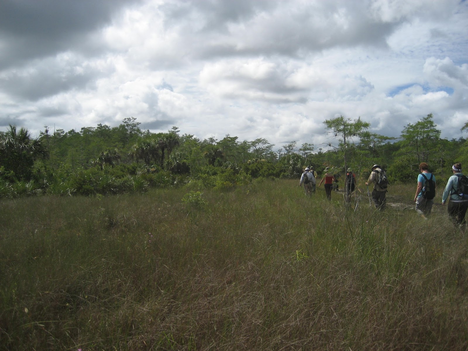
The previous day we dropped one car off at Neels Gap, where we initially had intended to finish our hike. We woke up early in Helen and set out to Amicalola Falls State Park, making a quick stop in Dahlonega for some last minute items. We started out on the Approach Trail at about 9:30 AM with our 35lb packs. Not too far into the hike we realized it was going to be a rough day.

Going up Springer Mountain was definitely a challenge. The total elevation gain was ~1,200ft. With every step, ever closer to the peak, the more painful and seemingly terrible the day seemed. At first, we were psyched to start out our AT adventure with the Approach Trail ‘warm up,’ but our high spirits slowly started to seep out of our pores while we sweated up the mountain. During our trek towards the top, Auz’s hip tendinitis came out of the darkness and almost took her out of the race. It was an incredibly painful and spirit crushing experience, practically dragging her right leg up the mountain face. Stair case after staircase, and steep switchbacks, we pushed on for 7.5 hours, until we reached the summit of Springer. Finally at the peak, the incredible amount of pain that you schlepped up “Penitentiary Mountain” is lifted off your sore shoulders as you drop your pack on the ground, turn around and take in the breathtaking views.


Admiring the plaque signifying your official start of the AT, to the right, nestled in the rock, there is a slot with a metal door where you can sign the hiker log and read about others’ experiences and revelations, once they’ve finally reached the end of the Approach Trail and the beginning of a journey.


Springer Mountain Shelter was a large compound with a variety of different tent sites, numerous bear cables, a mouldering privy, and a nice stream for water. We decided to set up our tents near the shelter itself. While filtering our water for the evening, we came across a fellow hiker, 'Dream Girl,' who shared her insight and kind words with us. That evening after feasting on delicious Indian food (Tasty Bites), rice and red wine, we enjoyed a campfire with 2 young, relatively inexperienced guys from Ohio who were carrying a month's worth of food, along with a bottle of Maker's Mark Whiskey, and an eccentric guy from Germany who has hiked in almost every country in the UK, and had 3 months to kill on US trails, carrying a 60 lb pack.

Day 1 Food:
Breakfast: Quaker Oatmeal
Lunch: Hard Salami, Aged Gouda, mustard and Pita bread
Dinner: Tasty Bites, Minute Rice, garlic Naan, red wine
Snacks: Homemade beef jerky, Chipotle Lime Cashews, Crystal Light Lemonade, Honeycomb Crisp Chocolate Bar

Day 2
7.6 miles
Springer Mountain Shelter to Hawk Mountain Shelter

After a relatively restless night's sleep, the next morning was filled with doubt and apprehension on whether or not Auz was going to continue the trail or go back down Springer Mountain and sulk in her deflated pride. Luckily, after packing up camp and eating a hearty breakfast, we decided that turning around would be harder than pressing on. Plus, we wouldn't have much to write about!


4.7 miles after leaving the shelter, there is a 0.1 mile side trail to Long Creek Falls, which is well worth it! It is a gorgeous waterfall which offers a swimming hole on hot days. After about another mile, the trail will pass an old corn/wheat field on the right side before reaching an unmarked dirt road. Hanging a left onto the road will lead you to Hickory Flatts Cemetery about 1/4 mile up. There is a privy, campfire ring, and a pavilion with a sign welcoming hikers. Many of the gravestones date back to the early 1900s and some have no writing left on them at all. Definitely worth the short walk!


Upon our arrival at Hawk Mountain shelter, the same 2 guys from Ohio had already been there since lunch. We went down to the water source, down a path to the LEFT of the shelter, since the trail was somewhat ambiguous and not clearly marked. We took a short and cold shower, filtered water and limped back up the trail to the camp, where we set up our tents and prepared dinner. While we were making our delicious pasta feast, an older gentleman, ‘Doc,’ arrived at the shelter. He was doing a charity hike and constantly repeated the phrase, “Hike your own hike.”

We ate dinner, shared stories, read the shelter log and soon went to sleep. Sadly, our slumber was rudely interrupted by nature, who doesn’t ask for permission, with rain pouring down on our camp in the middle of the night. Because of Megan’s quick reaction, the majority of our gear didn’t get totally soaked through, however, we did have clothes on a line “drying” at the time, which ended up as causalities of the poor weather.


Day 2 Food:
Breakfast: Oatmeal
Lunch: Hard Salami, Aged Gouda, mustard, Pita bread
Dinner: Thru Hiker Spaghetti, Pita Bread, Don Sergio Anejo Tequila
Snacks: Homemade beef jerky, Chipotle Lime Cashews, Crystal light lemonade, Bacon Chocolate Bar

Day 3
7.3 miles
Hawk Mountain Shelter to Gooch Mountain Shelter

The following morning, Auz had her watch set for 5:30am, still raining. 5:45am came around, still raining. 6:45am, guess what? Still raining, but we had to get out of Hawk Mountain shelter and get back to the trail. Collectively, we begrudgingly folded up our wet and muddy tents, ate breakfast and hopped back on the trail. Soon after the sun came out and dried our dampened spirits off, we continued on an incredibly beautiful and relatively easy trail towards Gooch Mountain Shelter.

Sassafras Mountain. What not to say about Sassafras Mountain? Okay, I'll be fair and say that it was absolutely beautiful, but that being said, the amount of beauty matched the amount of muscle it took to make it up that mountain. Steep switchbacks, seemingly endless staircases, sheer rock cliffs, heavenly views and the feeling of accomplishment you when you've reached the top, was unmatched by any other section of the trail.


Gooch Mountain was the prettiest of the 3 shelters we stayed at on this trip. The side trails were well marked and the tent sites were all gorgeous. Having nice company also doesn't hurt! We ended up being surrounded by 4 lawyers. Three of them were friends from college, one apparently was reformed, and had stopped practicing to write a book. The 4th was an environmental lawyer and worked for Levy County, FL. Not only did he have a mini dachshund (Lollipop! Megan's puppy dog), but it was his first time on the trail after open heart surgery in January. His friend and neighbor had an annual hiking trip that they hadn't missed in over 35 years. They both had sons, who were best friends, and were extremely outgoing and friendly. The company was kind, comforting and entertaining, to say the least.


Day 3 Food:
Breakfast: Quaker Oatmeal
Lunch: Hard Salami with Truffle, Aged Gouda, mustard, Pita bread
Dinner: Lost Cowboy Chili, Minute Rice, Don Sergio Anejo Tequila, Dehydrated hummus mix
Snacks: Chipotle Chocolate

Day 4
5 miles
Gooch Mountain Shelter to Woody Gap

For once, Auz left Megan in the dust. Knowing that by the end of the trail, she would be drinking cold German beers in the Old Bavaria Inn Lounge during their Happy Hour, she literally ran parts of the trail. Adelae was glad that someone could finally keep up with her. The 5 miles seemed to fly by under our swift feet, as the end of the trail leveled out and opened up to the beautiful Woody Gap. Originally, we were going to continue to Woods Hole shelter, and continue on to Neel’s Gap the next day, which would have been 15.5 miles total. The plans changed for the betterment of Auz’s leg, and the weather after we got off the trail started to deteriorate. The next 2 days were filled with rain, and the sky was overcast with thick, wet fog which settled close to the ground.

Day 4 Food:
Breakfast: Justin's Organic Peanut Butter (Honey and Chocolate), Pita bread
Lunch: Hard Salami with Truffles, Aged Gouda, mustard, Pita bread
Snacks: Toblerone, Chipotle Lime Cashews, Homemade beef jerky

27.6 Total Miles Hiked

After 2 days of rest, we attempted to finish our Woody Gap to Neel’s Gap segment, but again, the weather didn’t cooperate. We investigated the store at the Walasi-Yi center, where there is a full hostel and gear store. Driving up to the store, we were relieved that we were no longer on the trail, due to the freezing, wet fog that had settled on top of the mountain.