The next morning after our Blood Mountain hike, Auz and I got up fairly early to pack up the car, eat some breakfast then meet Lumpy at our terminus which was the end of Deep Gap Rd in NC. Prior to our trip I had tried to find this area on Google Earth because I suspected that there wouldn't be much in terms of cell phone reception in that area. I was correct. Luckily, I had mapped out exactly which turns to take down the almost 15 miles of dirt road we had to drive. Because it was still dark out it was a little spooky going down Deep Gap Rd with no cell phone reception in case something went wrong. We found Lumpy at the bottom of the gap with no problem! After moving our stuff to his van, we locked our car, and started the drive back to Hogpen Gap, GA. The drive took about 1.5 hours and on the way he told us stories about how he was frequently mistaken for one of the members of Duck Dynasty (there was an uncanny resemblance).
He dropped us off at the Hogpen Gap trailhead and told us to text him when we emerged from the trail a few days later. It was lightly raining so we started off with our rain gear on. As usual, within a mile we were too hot from the impenetrable jackets and took them off. The first 4 of 11.5 miles were fairly flat and felt really easy compared to the Blood Mountain hike the day before. We stopped for a snack of almond butter on pita bread at Low Gap Shelter. We were not planning on staying here overnight but it was really a beautiful area. There was a small creek that ran right through camp. There was a note on the shelter wall warning of a Cottonmouth snake in the privy. We went up the side trail to check it out. Because Auz is a Herpetologist by hobby she found the snake but confirmed it was not a Cottonmouth but merely a brown water snake so we edited the prior warning note. Just before leaving the shelter 2 women came down to use the privy and we told them about the snake. They were actually running 30 miles of the trail that day and we would probably see them later.
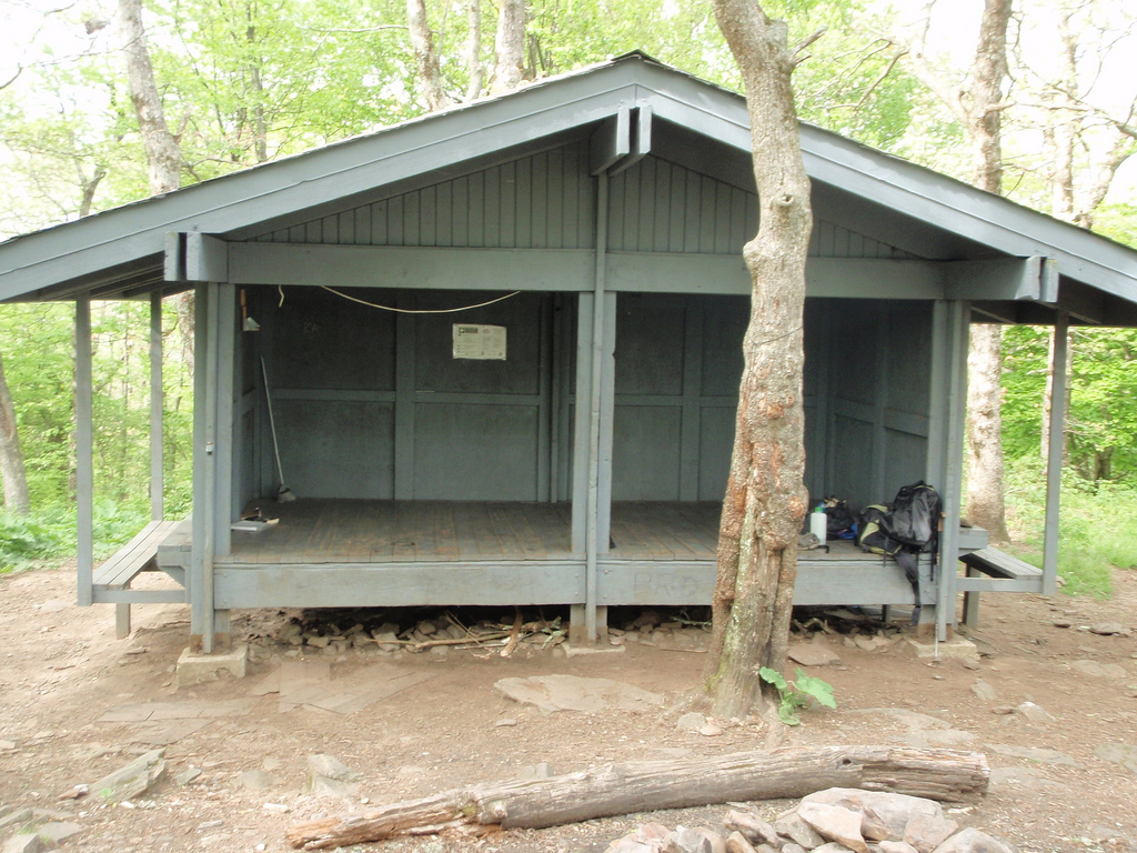
The next 4 miles followed a gentle uphill and were also fairly easy on us considering the weather. We then reached a short steep descent followed by 3 more miles of ascent before reaching the Blue Mountain Shelter. Right as we were about to get to the turnoff, the skies opened up and it started pouring. At this point we started a near jog on the trail but were confused by the signs. We knew the shelter trail was supposed to be on the left, yet there was a sign pointing us straight ahead. After going straight, we realized we had probably passed it and turned around. Back at the sign we turned down that trail and found the shelter. We changed into dry clothes and decided to just set up our tent sans rainfly inside the shelter since no one was there and it was nearly 5 PM. We made a delicious dinner of Tasty Bites Indian food followed by some maple cookies we had picked up at Trader Joe's that lacked any real maple flavor.
Blue Mountain Shelter (not my picture)
Around 8 PM we were just relaxing in the shelter listening to the rain when we heard voices approaching. Soon, 2 guys appeared at the shelter and told us that 2 more of their buddies were on their way. They were young guys from New Orleans and Phoenix. We watched as they began unloading their massive backpacks. They pulled out what looked like a 40 lb Coleman tent, a large metal pot, cases of ramen noodles and packets of tuna fish. They divvied up the chores of filtering water, setting up the tent, and starting a fire. The thought of even attempting a fire hadn't occurred to us since it had been raining for days and all the wood was soaked through. We watched as they used a machete to attempt to chop firewood and get that going. We were a bit confused as to why they were so determined to get a fire going until we realized that they hadn't packed a stove and needed to fire in order to make their dinner. What a mess. They were so unprepared! We fell asleep shortly after but I don't think they went to bed until midnight.
Our watch alarms were set to go off at 6 AM the next morning but upon awakening, we realized it was still raining and decided to wait another hour. A few minutes later one of the guys stumbled into the shelter with his sleeping bag and asked if he could sleep in there since their tent had flooded. Big surprise...that's what cheap tents do. He said they were also planning on hiking to Tray Mountain Shelter that night. We said we would see them later and started packing up our gear and making breakfast. We wanted to get an early started since we knew today's hike would be challenging. There was the steep 1 mile descent into Unicoi Gap, followed by the 1+ mile steep ascent up Rocky Mountain. Then there was the Other steep descent to Indian Grave Gap, an ascent to the "Cheese Factory" campsite (named after an old dairy farm that used to be in the area), and on last climb over Tray Mountain. While it was only going to be a 7.5 mile day, it was all diagonal. It also rained all day which added to the fun. We stopped for a short wet break at Indian Grave Gap which we had been to years before when we hiked up the Andrews Cove Trail from SR 75 outside Helen. Here we had a quick lunch of red pepper hummus and crackers. Parts of this section of the trail were very rocky and precarious when wet.
Because there were few stops, we reached the shelter pretty quickly and before 3 PM. After setting up our tent, we went to find water. Unfortunately for our tired legs, it was a long descent down a steep hill to get to the water source. After trudging back up the mountain, we decided we had the time for a quick rinse in the creek. We grabbed a change of clothes and our pack towels and headed back down to the water source to rinse off. The skies finally cleared up a bit and we relaxed in the shelter and watched 2 salamanders on a log. A bit later, a couple and their two dogs joined us in the shelter. They said hello but not much else to us that day. The 4 guys from the previous night never did make it. We assumed they hitched a ride back to Helen at Unicoi Gap. For dinner we made gluten-free pasta (we wanted to test this out since it cooks in half the time as wheat pasta with a very similar texture) and rehydrated some olive and tomato sauce. It was delicious on a rainy night.
Tray Mountain Shelter (not my picture)
Attempting to dry our clothes at Tray Mountain Shelter in the rain
(my picture)
The next morning, our spirits were lifted as we saw hints of blue in the sky. This was the first blue sky we had seen since arriving in Georgia! We happily made breakfast, fetched more water, and packed up our gear only to get rained on within 1/2 mile of hiking! Downtrodden, we continued our descent to Wolfpen Gap. Today our plan was to go 7.5 miles to Deep Gap Shelter. The beginning part of our hike was slightly hilly but nothing too crazy. After Sassafras Gap we had a steep descent to Addis Gap followed by a long, difficult climb over Kelly Knob then the final descent to Deep Gap. Maybe it was because we had been hiking for a few days but I would put the difficulty of Kelly Knob up there with Blood Mountain. It was hard!
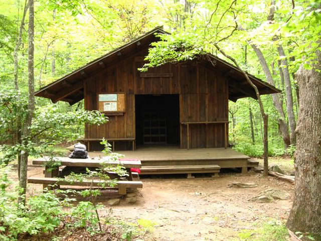
Deep Gap Shelter was an actual enclosed 2-story cabin type shelter. The privy also had a roof on it (the previous ones hadn't and were disgustingly slimy) so we were living in style now! We got there really early at around 1 PM and because EVERYTHING was wet from so many days of rain, we hung up our gear all over the shelter. We hadn't stopped for lunch so we ate our pita bread and Justin's Maple Almond butter. Because the roof on the shelter had recently been replaced the ground around it was littered with nails. We picked up as many as we could because it would really suck to get one of those rusty things stuck in your foot.
A couple of hours later a flip-flopping thru-hiker named Dragon Stick joined us. We moved our drying gear to make a spot for him in the shelter. Because of the relentless rain, we sat on the front porch and he told us about his hike and his gear. He lived near DC so he had started in Shenandoah and hiked north to Katahdin in Maine. There he got on a plane and headed to Atlanta to hike from Springer back to Shenandoah. His trail name was from his hiking stick that he had carved in the shape of a dragon complete with sharks teeth in its mouth. While he was retired, he was still on the board of some organization and carried with him 8 cell phone batteries so that he was always reachable. His wife was also able to call him daily on the trail. It was so strange to hear text message noises out here! For dinner I made a cous cous pilaf with rehydrated vegetable and spices and cookies for dessert.
Deep Gap Shelter (not my picture)
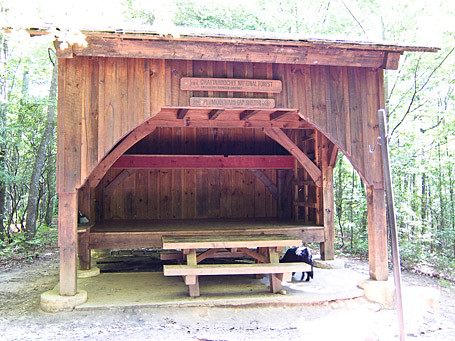
The next morning we had a leisurely breakfast then headed out. Dragon Stick said he would see us that evening at Plumorchard Gap shelter but he was staying here until noon to take a conference call since he had good reception. We had an 8 mile day ahead of us with some pretty challenging climbs. The first challenge was a steep 1 mile descent from Powell Mountain into Moreland Gap followed by a further descent to Dicks Creek Gap. Overall the first 4 miles of the day were pretty quick. From the road crossing we had the 1+ mile steep climb up Buzzard Knob, a short dip into Bull Gap, then the final descent towards Plumorchard Gap which seemed to go on forever! While the map claims that it is only 0.2 mi off the main trail, it was by far the longest 0.2 mi of the day. We crossed over the creek and water source and finally arrived at the beautiful shelter. This shelter was a 3 story one with lots of hooks for hanging things. Had it not been so overcast, this would have been the prettiest one yet (minus the loads of trash in the fire pit, c'mon, a tire???)
Plumorchard Gap Shelter (not my picture)
Path to the Privy (Auz's picture)
It was still raining so we decided to put out our bowls to collect water in that we could filter later to save ourselves a trip to the creek. We checked out the privy which was also fancy, covered and lacked snakes. We put on the driest clothes we had which were still pretty soggy and ran some line to attempt to dry our belongings in 95% humidity. I had been sleeping in a damp but warm sleeping back for so many nights, what was one more?
Our clothesline at Plumorchard Shelter at night
(This is our picture which is why it sucks)
Dragon Stick arrived at the shelter a few hours after we did. He said he ran into a father and daughter who claimed they were heading to the shelter for the night but they never did make it. Probably gave up due to the rain and turned back to the car. For dinner we ate our last packets of Tasty Bites Indian food and gorged ourselves on snacks and cookies, leaving just enough for the next day's lunch. We hung the remainder of our food on the bear cables and went to bed early. We had a 12 mile day in the morning so we set our watch alarms for 5 AM. Dragon Stick also wanted to wake up at that time since he had an 18 mile day ahead of him. That night we heard coyotes a few times as well, which was awesome. In the morning, Dragon Stick yelled that a small rodent had gotten into our food. Upon investigating, his bag had been torn open and he was missing some granola bars but our just had a small tear. We shoved our soaking wet clothes and gear into our packs, ate our Banana Walnut Chia Seed Oatmeal and got more water.
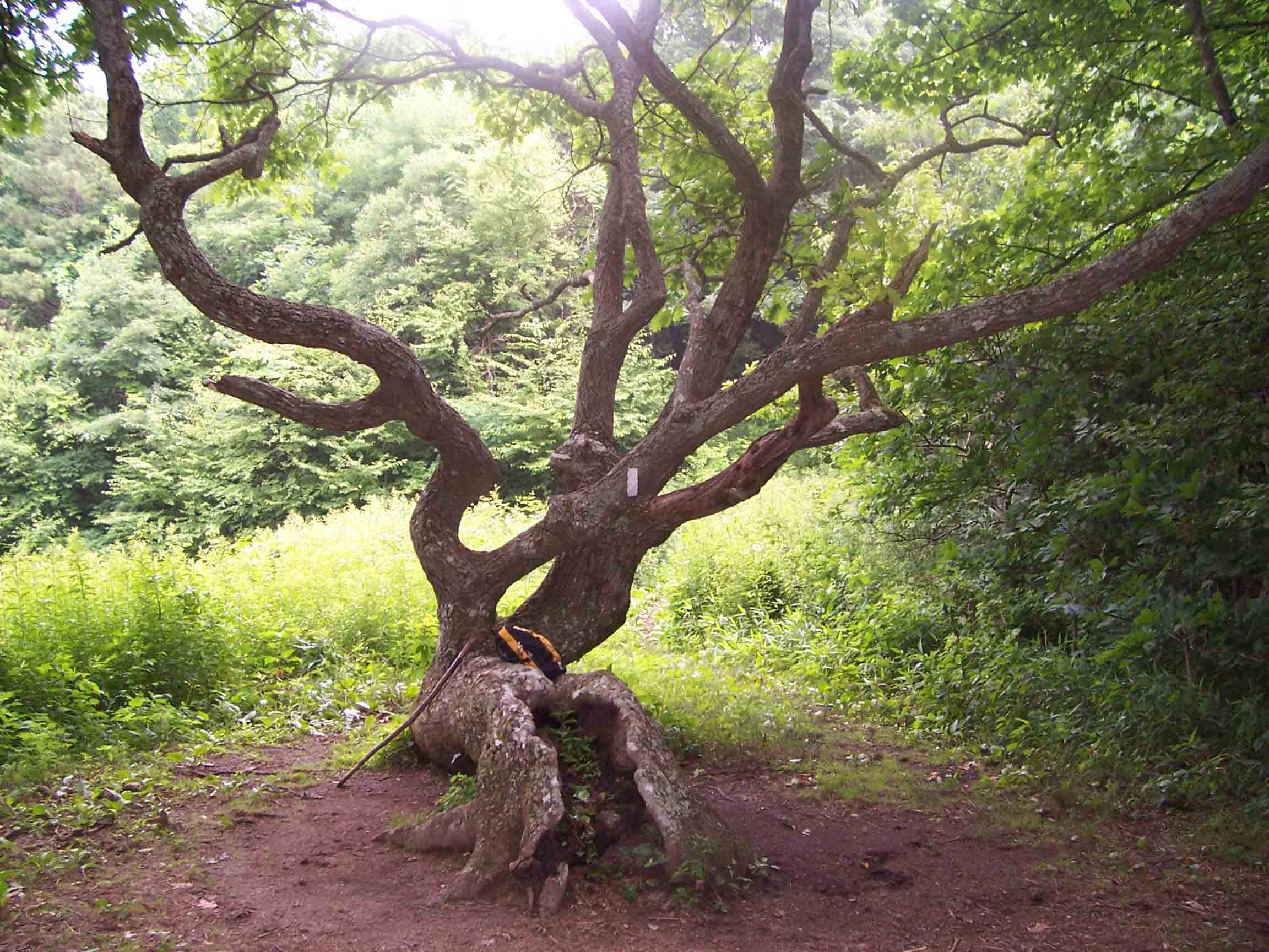
There was a small climb over As Knob in the morning followed by a gentle climb for a couple miles to the GA-NC border. The rain had finally let up! It was such a pleasure to not be hiking in a downpour for once! The first 5 miles to to the border went by really quickly. After crossing the border, there is a short climb up to Bly Gap where there is an awesome tree and a beautiful meadow of flowers.
Bly Gap Tree
(not my picture)
From here, we had a incredibly steep climb up Sharp Top. The unnamed peak you climb over right after was equally as sheer of a climb. From this point on the trail looks very different from Georgia. We entered a rhododendron tunnel followed by a foggy pine forest and lots of wild flowers. After about 8 miles, Auz became exhausted with only 4 miles to go. Her feet were also in pretty bad shape from being wet in too small boots for too many days. Meanwhile, my back was hurting more than my feet from having a too large backpack (see backpack review). I talked her through the last part of our hike by telling her summaries of pretty much every movie I had seen in the past 3 years. The last mile of the day/trip was the longest and hardest. It was downhill and slick rocks on tired legs. When we FINALLY reached the card, Auz removed her boots and promptly threw them in the nearby trashcan, wishing to never touch them again. We put on our flip flops, threw our wet bags on towels in the backseat, and headed back up Deep Gap Rd to the highway.
Our plan was to drive back to Helen and stay at the Heidi Motel for the evening to relax and regroup before our long drive home in the morning. We checked into our room, which was quick spacious and clean, showered, then headed into town to eat at La Cabana for the third time on this trip. After lunch/dinner, we went to the park next to our hotel and sat on the bench swing for awhile. We then went down the hill to the small grocery store, bought some sodas, went back to the room and watched TV until we fell asleep.
Heidi Motel
(not my picture)
In the morning we packed up the car and headed towards Atlanta to return my backpack at REI. Afterwards, we had a long drive back to Gainesville, FL. On the way, we decided we were sick of the car and took a small detour to go to Horse Creek Winery in Nashville, GA. Conveniently, it was Happy Hour so the wine tastings were 1/2 off. After tasting a few wines and being very unimpressed, we sat on their beautiful front porch for a bit before heading back to the car.
Wine on the front porch of Horse Creek Winery
Overall, we hiked almost 50 miles in 5 days. It was a very difficult, wet, but fun trip. Our feet are still recovering and yet we are already discussing plans for our next hike.


No comments:
Post a Comment