Showing posts with label backpacking. Show all posts

Wednesday, January 22, 2014

Florida Trail: Tamiami Trail to I-75

This past weekend I joined a group of hikers for a 3-day backpacking adventure through the section of the Florida Trail that crosses Big Cypress between the Oasis Visitor Center on Tamiami Trail to Mile Marker 63 on I-75.  We were a group of 10 hikers with 2 others joining us just for one night who were then heading back to Oasis.  The weather had been pretty warm leading up to the trip but temperatures dropped quickly a few days before, which meant we wouldn't have to worry about bugs!  We met early on Saturday morning at the Oasis Visitor Center and finished some quick packing and making sure everyone was prepared with proper footwear and hiking poles.


We finally started hiking around 8:30 AM.  The trail was a lot easier than we thought it would be with water never being higher than ankle deep.  We stopped for lunch at 7-mile camp.  After eating, one member of our group who had hiked this section over 25 times took us into a cypress dome nearby to see the remnants of a Marine Bomber plane that had crashed there in the 1940s.  On the way there, we saw a Fish & Wildlife officer on a swamp buggy and invited him to join us in the dome.  It must have been a bad plane crash since pieces of the plane were all over the dome.


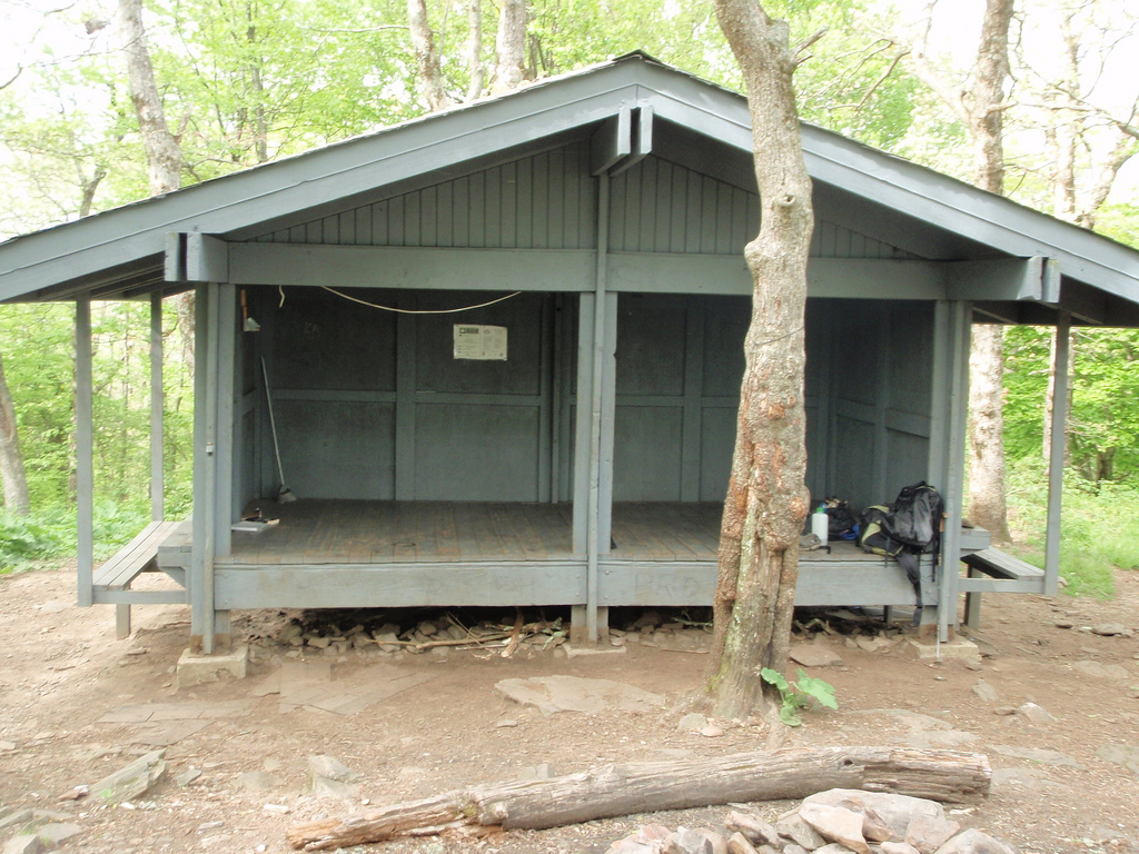
We headed on for the last 3 miles to 10 mile camp, some of which had some very sticky mud that wore us out.  10 mile camp was very large.  It was nice, flat pineland with many scrub palmettos with many tent sites available.  We pitched our tents then headed to the nearby cypress dome to filter water.  We were able to collect lots of firewood for that evening since we knew it would get down to around 40 degrees.  We had a relaxing evening around the campfire.  Because the site way fairly open we were able to view the stars and watch the moon rise.  We were all in bed by 9:30 though.


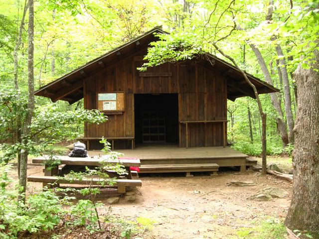
Relaxing at 10 Mile Camp

Our tent

Being fashionable at camp

Sunset at 10 Mile Camp

The next morning we got a bit of a late start at 9 AM.  According to our maps, we had 12.2 miles to get to Oak Hill Camp.  The plan was to stop at 13-mile camp for lunch.  13-mile camp is actually 7 miles north of 10-mile camp but is 13 miles from I-75.  The first bit of trail was very muddy and wet.  But the whole morning we were in and out of cypress/mud and pines/grass.  The neat thing about hiking in shallow mud is being able to see all the animal tracks.  We saw panther, coyote, deer, and raccoon tracks all along the FT.  At one point we were on dry land for quite a while which allowed us to pick up some speed.  We got to our lunch spot at around 1 PM.  13-mile camp is quite overgrown and not very large.  It is dry, though, with some palms and pines.

Heading out from 10 Mile Camp

Trail at start of Day 2

We were under the impression that it was only another 5.2 miles to get to Oak Hill Camp with a halfway point at what was marked as "Barbed Wire Fence" on the map.  Leaving at 1:45 PM we figured we would get to camp in plenty of time.  Unfortunately, we did not know what type of terrain lied ahead.  I ended up hiking mostly with my dad in the afternoon and the first section wasn't too bad but we kept wondering why it was taking so long to find the fence.  We finally got there around 3:30 PM.  That meant we still had 2.6 miles to go with sunset being at 6 PM.  After leaving the fence, you find yourself in complete cypress forest walking through knee deep, uneven sticky mud and water.  

Very wet trail


This slowed us down tremendously.  I had chosen to wear Keen sandals which was not smart since the mud was pulling them off my feet every 10 steps, slowing me down even more.  We were already tired from hiking so this section just sapped the rest of our energy.  What else was frustrating was that the sun was slowly getting closer to the horizon and there were no pine trees or dry land in sight.  Finally around 5:45 PM when we only had about 15-20 minutes left of day light, we saw some pine trees up ahead.  We figured we could at least stop there and retrieve our headlamps to navigate in the dark.  You can imagine our excitement when we realized that this was our campsite.  2 others from our group had already arrived and had the fire going.  However, there were still 6 other hikers way behind us.  We collected water and tried to have things ready to help the others when they arrived after dark.  The last group finally arrive at 6:15 PM.  Just as the last rays of sun disappeared.  According to our trip leader's GPS, we had hiked 14 miles that day, without ever leaving the trail.  This meant that the map numbers were not accurate for that section.  Exhausted and dehydrated, we ate dinner and sat around the campfire.

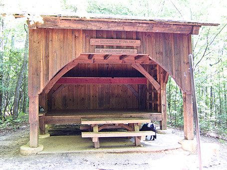
Relaxing at Oak Hill Camp

In the morning we were able to appreciate the beauty of Oak Hill Camp.  There are oaks, palms, and many other types of trees on this small area of raised land in a sea of cypress swamp.  There are a few tent areas with a main trail going through the "island".  The best place we found to collect water from was right on the trail.  There isn't a whole lot of privacy here and when nature calls you end up having to bushwhack through some brushy areas.  Luckily, the weather was chilly because had it not been, this would have been mosquito heaven.  Overall, I would recommend camping at Oak Hill Camp, but if coming from 10-mile camp, make sure to get an early start.  On our last day, we packed up camp and got a bit of an earlier start at 8:30 AM.  Our pickup time at I-75 was set for 3 PM and we didn't want to make anyone wait.  It was 7-8 miles back to the highway.  We agreed to meet at Ivy Camp for lunch.

First part of trail on Day 3


The last morning was by far the worst part of the trail.  I didn't know there were that many types of mud. Throughout the trip we hiked through sticky mud, dry mud, shallow mud, cottage cheese mud, squishy mud...you get the picture.  The 4 miles between Oak Hill Camp and Ivy Camp were through knee deep water with squishy/sticky mud and uneven ground underneath it.  Not being the front, you can't see the bottom so you have no idea if the ground you are stepping on will be 4 inches under the water or 12.  The best way to described it is that you feel like a drunk, blind person trying to walk on sand with bricks tied to your feet.  Normally, I only use one hiking pole but I think I would have been better off with two since I kept my pole in my right hand and was grabbing onto any small cypress tree I could with my left.  To fix my shoe situation, I had wrapped the tightening elastic around my ankles, which caused the plastic piece to dig into my skin which hurt a lot but it was really the only choice I had.  We were exhausted after 1.5 hours of hiking and found we were only doing about a 45-minute mile.  It tooks us 3 hours of non-stop hiking to get the Ivy Camp.  Ivy Camp was very small with almost no privacy but it did have to beautiful cypress domes nearby.

Stopped for lunch at Ivy Camp

Seven of us had our lunch there while waiting for the last three hikers.  After 45 minutes, we called them on our hand held radios and they said they were stopping at a previous hammock we had seen for lunch since they were too tired but would get back on the trail soon.  We told them we were going to head out and that instead of taking the trail the whole way, we were going to take a service road to shave off 1/2 mile.  The service road was mostly underwater but at least the mud underneath was a bit firmer and easier to walk on.  We were able to blast through the last 3-4 miles in no time.  The FT eventually merges with this road and we arrived at I-75 around 2:45 PM.  The 3 hikers in the back had only reached Ivy Camp at 2 PM due to water filtering issues and assumed the afternoon was going to be as difficult and radioed to us that they probably wouldn't be out until 6 PM.  We told them to take the service road since it was much easier and it wouldn't take them that long.  Unfortunately, they missed the road turnoff and followed the trail back, but got there around 4 PM.


We made it!

The Florida Trail makes the Appalachian Trail seem luxurious with all its shelters and picnic tables.  On the Florida Trail, you're just happy to have dry land.  This was one of the most exhausting trips I have even been on.  I haven't yet decided if I would do it again.  For anyone interested in doing this section, here is some advice:

Footwear:  Do not wear Keens or any other type of sandal that allows in debris.  The first 2 days, I wore Keens with no socks and I was constantly stopping to pull twigs and rocks out of my shoes.  These types of shoes also build up a 1/2" layer of mud between the sole and your foot.  On day 3, I wore socks with them and this kept out most of the debris but they were still full of mud.  Keens are just not built to withstand this kind of abuse since mine were brand new when I started and by the time I finished, a lot of the glue and stitching had come undone.  The hikers in our group who had no problem at all were all wearing minimalist sneakers.  Even my dad just wore a basic pair of Reebok sneakers and didn't have any issues with the mud.  Also, I highly recommend socks because we found that those without socks were getting bitten by black water beetles.

Pants:  Wear long pants!  Yes they were get a bit heavier from being wet, but if you don't your legs will be completely cut up from the sawgrass.

Weather:  Most of the campsite would be insanely buggy if it were not cool out, especially Oak Hill and Ivy Camps.  Make sure to pack bugspray if it is not going to be cold out.

Pack weight:  Walking on that kind of terrain already throws your balance of tremendously, so having a light pack is key.  No one in our group had a pack over 30 lbs and no one had problems with their weight.

Wednesday, August 28, 2013

Appalachian Trail: Hogpen Gap, GA to Deep Gap, NC

Warning:  This is a very long post because it includes 5 days of hiking on the Appalachian Trail.  I also apologize for the lack of photos in the post.  The camera I brought was old and the battery died within a day.  Most of the pictures in the post were borrowed from the internet.  I take no credit for them.

The next morning after our Blood Mountain hike, Auz and I got up fairly early to pack up the car, eat some breakfast then meet Lumpy at our terminus which was the end of Deep Gap Rd in NC.  Prior to our trip I had tried to find this area on Google Earth because I suspected that there wouldn't be much in terms of cell phone reception in that area.  I was correct.  Luckily, I had mapped out exactly which turns to take down the almost 15 miles of dirt road we had to drive.  Because it was still dark out it was a little spooky going down Deep Gap Rd with no cell phone reception in case something went wrong.  We found Lumpy at the bottom of the gap with no problem!  After moving our stuff to his van, we locked our car, and started the drive back to Hogpen Gap, GA.  The drive took about 1.5 hours and on the way he told us stories about how he was frequently mistaken for one of the members of Duck Dynasty (there was an uncanny resemblance).

He dropped us off at the Hogpen Gap trailhead and told us to text him when we emerged from the trail a few days later.  It was lightly raining so we started off with our rain gear on.  As usual, within a mile we were too hot from the impenetrable jackets and took them off.  The first 4 of 11.5 miles were fairly flat and felt really easy compared to the Blood Mountain hike the day before.  We stopped for a snack of almond butter on pita bread at Low Gap Shelter.  We were not planning on staying here overnight but it was really a beautiful area.  There was a small creek that ran right through camp.  There was a note on the shelter wall warning of a Cottonmouth snake in the privy.  We went up the side trail to check it out.  Because Auz is a Herpetologist by hobby she found the snake but confirmed it was not a Cottonmouth but merely a brown water snake so we edited the prior warning note.  Just before leaving the shelter 2 women came down to use the privy and we told them about the snake.  They were actually running 30 miles of the trail that day and we would probably see them later.

The next 4 miles followed a gentle uphill and were also fairly easy on us considering the weather.  We then reached a short steep descent followed by 3 more miles of ascent before reaching the Blue Mountain Shelter.  Right as we were about to get to the turnoff, the skies opened up and it started pouring.  At this point we started a near jog on the trail but were confused by the signs.  We knew the shelter trail was supposed to be on the left, yet there was a sign pointing us straight ahead.  After going straight, we realized we had probably passed it and turned around.  Back at the sign we turned down that trail and found the shelter.  We changed into dry clothes and decided to just set up our tent sans rainfly inside the shelter since no one was there and it was nearly 5 PM. We made a delicious dinner of Tasty Bites Indian food followed by some maple cookies we had picked up at Trader Joe's that lacked any real maple flavor.

Blue Mountain Shelter (not my picture)

Around 8 PM we were just relaxing in the shelter listening to the rain when we heard voices approaching.  Soon, 2 guys appeared at the shelter and told us that 2 more of their buddies were on their way.  They were young guys from New Orleans and Phoenix.  We watched as they began unloading their massive backpacks.  They pulled out what looked like a 40 lb Coleman tent, a large metal pot, cases of ramen noodles and packets of tuna fish.  They divvied up the chores of filtering water, setting up the tent, and starting a fire.  The thought of even attempting a fire hadn't occurred to us since it had been raining for days and all the wood was soaked through.  We watched as they used a machete to attempt to chop firewood and get that going.  We were a bit confused as to why they were so determined to get a fire going until we realized that they hadn't packed a stove and needed to fire in order to make their dinner.  What a mess.  They were so unprepared!  We fell asleep shortly after but I don't think they went to bed until midnight.

Our watch alarms were set to go off at 6 AM the next morning but upon awakening, we realized it was still raining and decided to wait another hour.  A few minutes later one of the guys stumbled into the shelter with his sleeping bag and asked if he could sleep in there since their tent had flooded.  Big surprise...that's what cheap tents do.  He said they were also planning on hiking to Tray Mountain Shelter that night.  We said we would see them later and started packing up our gear and making breakfast.  We wanted to get an early started since we knew today's hike would be challenging.  There was the steep 1 mile descent into Unicoi Gap, followed by the 1+ mile steep ascent up Rocky Mountain.  Then there was the Other steep descent to Indian Grave Gap, an ascent to the "Cheese Factory" campsite (named after an old dairy farm that used to be in the area), and on last climb over Tray Mountain.  While it was only going to be a 7.5 mile day, it was all diagonal.  It also rained all day which added to the fun.  We stopped for a short wet break at Indian Grave Gap which we had been to years before when we hiked up the Andrews Cove Trail from SR 75 outside Helen.  Here we had a quick lunch of red pepper hummus and crackers.  Parts of this section of the trail were very rocky and precarious when wet.

Because there were few stops, we reached the shelter pretty quickly and before 3 PM.  After setting up our tent, we went to find water.  Unfortunately for our tired legs, it was a long descent down a steep hill to get to the water source.  After trudging back up the mountain, we decided we had the time for a quick rinse in the creek.  We grabbed a change of clothes and our pack towels and headed back down to the water source to rinse off.  The skies finally cleared up a bit and we relaxed in the shelter and watched 2 salamanders on a log.  A bit later, a couple and their two dogs joined us in the shelter.  They said hello but not much else to us that day.  The 4 guys from the previous night never did make it.  We assumed they hitched a ride back to Helen at Unicoi Gap.  For dinner we made gluten-free pasta (we wanted to test this out since it cooks in half the time as wheat pasta with a very similar texture) and rehydrated some olive and tomato sauce.  It was delicious on a rainy night.

Tray Mountain Shelter (not my picture)

Attempting to dry our clothes at Tray Mountain Shelter in the rain
(my picture)


The next morning, our spirits were lifted as we saw hints of blue in the sky.  This was the first blue sky we had seen since arriving in Georgia!  We happily made breakfast, fetched more water, and packed up our gear only to get rained on within 1/2 mile of hiking!  Downtrodden, we continued our descent to Wolfpen Gap.  Today our plan was to go 7.5 miles to Deep Gap Shelter.  The beginning part of our hike was slightly hilly but nothing too crazy.  After Sassafras Gap we had a steep descent to Addis Gap followed by a long, difficult climb over Kelly Knob then the final descent to Deep Gap.  Maybe it was because we had been hiking for a few days but I would put the difficulty of Kelly Knob up there with Blood Mountain.  It was hard!

Deep Gap Shelter was an actual enclosed 2-story cabin type shelter.  The privy also had a roof on it (the previous ones hadn't and were disgustingly slimy) so we were living in style now!  We got there really early at around 1 PM and because EVERYTHING was wet from so many days of rain, we hung up our gear all over the shelter.  We hadn't stopped for lunch so we ate our pita bread and Justin's Maple Almond butter.  Because the roof on the shelter had recently been replaced the ground around it was littered with nails.  We picked up as many as we could because it would really suck to get one of those rusty things stuck in your foot.

A couple of hours later a flip-flopping thru-hiker named Dragon Stick joined us.  We moved our drying gear to make a spot for him in the shelter.  Because of the relentless rain, we sat on the front porch and he told us about his hike and his gear.  He lived near DC so he had started in Shenandoah and hiked north to Katahdin in Maine.  There he got on a plane and headed to Atlanta to hike from Springer back to Shenandoah.  His trail name was from his hiking stick that he had carved in the shape of a dragon complete with sharks teeth in its mouth.  While he was retired, he was still on the board of some organization and carried with him 8 cell phone batteries so that he was always reachable.  His wife was also able to call him daily on the trail.  It was so strange to hear text message noises out here!  For dinner I made a cous cous pilaf with rehydrated vegetable and spices and cookies for dessert.

Deep Gap Shelter (not my picture)

The next morning we had a leisurely breakfast then headed out.  Dragon Stick said he would see us that evening at Plumorchard Gap shelter but he was staying here until noon to take a conference call since he had good reception.  We had an 8 mile day ahead of us with some pretty challenging climbs.  The first challenge was a steep 1 mile descent from Powell Mountain into Moreland Gap followed by a further descent to Dicks Creek Gap.  Overall the first 4 miles of the day were pretty quick.  From the road crossing we had the 1+ mile steep climb up Buzzard Knob, a short dip into Bull Gap, then the final descent towards Plumorchard Gap which seemed to go on forever!  While the map claims that it is only 0.2 mi off the main trail, it was by far the longest 0.2 mi of the day.  We crossed over the creek and water source and finally arrived at the beautiful shelter.  This shelter was a 3 story one with lots of hooks for hanging things.  Had it not been so overcast, this would have been the prettiest one yet (minus the loads of trash in the fire pit, c'mon, a tire???)

Plumorchard Gap Shelter (not my picture)

Path to the Privy (Auz's picture)

It was still raining so we decided to put out our bowls to collect water in that we could filter later to save ourselves a trip to the creek.  We checked out the privy which was also fancy, covered and lacked snakes.  We put on the driest clothes we had which were still pretty soggy and ran some line to attempt to dry our belongings in 95% humidity.  I had been sleeping in a damp but warm sleeping back for so many nights, what was one more?

Our clothesline at Plumorchard Shelter at night
(This is our picture which is why it sucks)

Dragon Stick arrived at the shelter a few hours after we did.  He said he ran into a father and daughter who claimed they were heading to the shelter for the night but they never did make it.  Probably gave up due to the rain and turned back to the car.  For dinner we ate our last packets of Tasty Bites Indian food and gorged ourselves on snacks and cookies, leaving just enough for the next day's lunch.  We hung the remainder of our food on the bear cables and went to bed early.  We had a 12 mile day in the morning so we set our watch alarms for 5 AM.  Dragon Stick also wanted to wake up at that time since he had an 18 mile day ahead of him.  That night we heard coyotes a few times as well, which was awesome.  In the morning, Dragon Stick yelled that a small rodent had gotten into our food.  Upon investigating, his bag had been torn open and he was missing some granola bars but our just had a small tear.  We shoved our soaking wet clothes and gear into our packs, ate our Banana Walnut Chia Seed Oatmeal and got more water.

There was a small climb over As Knob in the morning followed by a gentle climb for a couple miles to the GA-NC border.  The rain had finally let up!  It was such a pleasure to not be hiking in a downpour for once!  The first 5 miles to to the border went by really quickly.  After crossing the border, there is a short climb up to Bly Gap where there is an awesome tree and a beautiful meadow of flowers.

Bly Gap Tree
(not my picture)

From here, we had a incredibly steep climb up Sharp Top.  The unnamed peak you climb over right after was equally as sheer of a climb.  From this point on the trail looks very different from Georgia.  We entered a rhododendron tunnel followed by a foggy pine forest and lots of wild flowers.  After about 8 miles, Auz became exhausted with only 4 miles to go.  Her feet were also in pretty bad shape from being wet in too small boots for too many days.  Meanwhile, my back was hurting more than my feet from having a too large backpack (see backpack review).  I talked her through the last part of our hike by telling her summaries of pretty much every movie I had seen in the past 3 years.  The last mile of the day/trip was the longest and hardest.  It was downhill and slick rocks on tired legs.  When we FINALLY reached the card, Auz removed her boots and promptly threw them in the nearby trashcan, wishing to never touch them again.  We put on our flip flops, threw our wet bags on towels in the backseat, and headed back up Deep Gap Rd to the highway.  

Our plan was to drive back to Helen and stay at the Heidi Motel for the evening to relax and regroup before our long drive home in the morning.  We checked into our room, which was quick spacious and clean, showered, then headed into town to eat at La Cabana for the third time on this trip.  After lunch/dinner, we went to the park next to our hotel and sat on the bench swing for awhile.  We then went down the hill to the small grocery store, bought some sodas, went back to the room and watched TV until we fell asleep.

Heidi Motel
(not my picture)

In the morning we packed up the car and headed towards Atlanta to return my backpack at REI.  Afterwards, we had a long drive back to Gainesville, FL.  On the way, we decided we were sick of the car and took a small detour to go to Horse Creek Winery in Nashville, GA.  Conveniently, it was Happy Hour so the wine tastings were 1/2 off.  After tasting a few wines and being very unimpressed, we sat on their beautiful front porch for a bit before heading back to the car.

Wine on the front porch of Horse Creek Winery

Overall, we hiked almost 50 miles in 5 days.  It was a very difficult, wet, but fun trip.  Our feet are still recovering and yet we are already discussing plans for our next hike.

Saturday, May 15, 2010

Appalachian Trail - GA: Amicalola Falls to Woody Gap

Day 1
7.7 miles
Amicalola Falls Lodge to Springer Mountain Shelter

The previous day we dropped one car off at Neels Gap, where we initially had intended to finish our hike. We woke up early in Helen and set out to Amicalola Falls State Park, making a quick stop in Dahlonega for some last minute items. We started out on the Approach Trail at about 9:30 AM with our 35lb packs. Not too far into the hike we realized it was going to be a rough day.

Going up Springer Mountain was definitely a challenge. The total elevation gain was ~1,200ft. With every step, ever closer to the peak, the more painful and seemingly terrible the day seemed. At first, we were psyched to start out our AT adventure with the Approach Trail ‘warm up,’ but our high spirits slowly started to seep out of our pores while we sweated up the mountain. During our trek towards the top, Auz’s hip tendinitis came out of the darkness and almost took her out of the race. It was an incredibly painful and spirit crushing experience, practically dragging her right leg up the mountain face. Stair case after staircase, and steep switchbacks, we pushed on for 7.5 hours, until we reached the summit of Springer. Finally at the peak, the incredible amount of pain that you schlepped up “Penitentiary Mountain” is lifted off your sore shoulders as you drop your pack on the ground, turn around and take in the breathtaking views.


Admiring the plaque signifying your official start of the AT, to the right, nestled in the rock, there is a slot with a metal door where you can sign the hiker log and read about others’ experiences and revelations, once they’ve finally reached the end of the Approach Trail and the beginning of a journey.


Springer Mountain Shelter was a large compound with a variety of different tent sites, numerous bear cables, a mouldering privy, and a nice stream for water. We decided to set up our tents near the shelter itself. While filtering our water for the evening, we came across a fellow hiker, 'Dream Girl,' who shared her insight and kind words with us. That evening after feasting on delicious Indian food (Tasty Bites), rice and red wine, we enjoyed a campfire with 2 young, relatively inexperienced guys from Ohio who were carrying a month's worth of food, along with a bottle of Maker's Mark Whiskey, and an eccentric guy from Germany who has hiked in almost every country in the UK, and had 3 months to kill on US trails, carrying a 60 lb pack.

Day 1 Food:
Breakfast: Quaker Oatmeal
Lunch: Hard Salami, Aged Gouda, mustard and Pita bread
Dinner: Tasty Bites, Minute Rice, garlic Naan, red wine
Snacks: Homemade beef jerky, Chipotle Lime Cashews, Crystal Light Lemonade, Honeycomb Crisp Chocolate Bar

Day 2
7.6 miles
Springer Mountain Shelter to Hawk Mountain Shelter

After a relatively restless night's sleep, the next morning was filled with doubt and apprehension on whether or not Auz was going to continue the trail or go back down Springer Mountain and sulk in her deflated pride. Luckily, after packing up camp and eating a hearty breakfast, we decided that turning around would be harder than pressing on. Plus, we wouldn't have much to write about!


4.7 miles after leaving the shelter, there is a 0.1 mile side trail to Long Creek Falls, which is well worth it! It is a gorgeous waterfall which offers a swimming hole on hot days. After about another mile, the trail will pass an old corn/wheat field on the right side before reaching an unmarked dirt road. Hanging a left onto the road will lead you to Hickory Flatts Cemetery about 1/4 mile up. There is a privy, campfire ring, and a pavilion with a sign welcoming hikers. Many of the gravestones date back to the early 1900s and some have no writing left on them at all. Definitely worth the short walk!


Upon our arrival at Hawk Mountain shelter, the same 2 guys from Ohio had already been there since lunch. We went down to the water source, down a path to the LEFT of the shelter, since the trail was somewhat ambiguous and not clearly marked. We took a short and cold shower, filtered water and limped back up the trail to the camp, where we set up our tents and prepared dinner. While we were making our delicious pasta feast, an older gentleman, ‘Doc,’ arrived at the shelter. He was doing a charity hike and constantly repeated the phrase, “Hike your own hike.”

We ate dinner, shared stories, read the shelter log and soon went to sleep. Sadly, our slumber was rudely interrupted by nature, who doesn’t ask for permission, with rain pouring down on our camp in the middle of the night. Because of Megan’s quick reaction, the majority of our gear didn’t get totally soaked through, however, we did have clothes on a line “drying” at the time, which ended up as causalities of the poor weather.


Day 2 Food:
Breakfast: Oatmeal
Lunch: Hard Salami, Aged Gouda, mustard, Pita bread
Dinner: Thru Hiker Spaghetti, Pita Bread, Don Sergio Anejo Tequila
Snacks: Homemade beef jerky, Chipotle Lime Cashews, Crystal light lemonade, Bacon Chocolate Bar

Day 3
7.3 miles
Hawk Mountain Shelter to Gooch Mountain Shelter

The following morning, Auz had her watch set for 5:30am, still raining. 5:45am came around, still raining. 6:45am, guess what? Still raining, but we had to get out of Hawk Mountain shelter and get back to the trail. Collectively, we begrudgingly folded up our wet and muddy tents, ate breakfast and hopped back on the trail. Soon after the sun came out and dried our dampened spirits off, we continued on an incredibly beautiful and relatively easy trail towards Gooch Mountain Shelter.

Sassafras Mountain. What not to say about Sassafras Mountain? Okay, I'll be fair and say that it was absolutely beautiful, but that being said, the amount of beauty matched the amount of muscle it took to make it up that mountain. Steep switchbacks, seemingly endless staircases, sheer rock cliffs, heavenly views and the feeling of accomplishment you when you've reached the top, was unmatched by any other section of the trail.


Gooch Mountain was the prettiest of the 3 shelters we stayed at on this trip. The side trails were well marked and the tent sites were all gorgeous. Having nice company also doesn't hurt! We ended up being surrounded by 4 lawyers. Three of them were friends from college, one apparently was reformed, and had stopped practicing to write a book. The 4th was an environmental lawyer and worked for Levy County, FL. Not only did he have a mini dachshund (Lollipop! Megan's puppy dog), but it was his first time on the trail after open heart surgery in January. His friend and neighbor had an annual hiking trip that they hadn't missed in over 35 years. They both had sons, who were best friends, and were extremely outgoing and friendly. The company was kind, comforting and entertaining, to say the least.


Day 3 Food:
Breakfast: Quaker Oatmeal
Lunch: Hard Salami with Truffle, Aged Gouda, mustard, Pita bread
Dinner: Lost Cowboy Chili, Minute Rice, Don Sergio Anejo Tequila, Dehydrated hummus mix
Snacks: Chipotle Chocolate

Day 4
5 miles
Gooch Mountain Shelter to Woody Gap

For once, Auz left Megan in the dust. Knowing that by the end of the trail, she would be drinking cold German beers in the Old Bavaria Inn Lounge during their Happy Hour, she literally ran parts of the trail. Adelae was glad that someone could finally keep up with her. The 5 miles seemed to fly by under our swift feet, as the end of the trail leveled out and opened up to the beautiful Woody Gap. Originally, we were going to continue to Woods Hole shelter, and continue on to Neel’s Gap the next day, which would have been 15.5 miles total. The plans changed for the betterment of Auz’s leg, and the weather after we got off the trail started to deteriorate. The next 2 days were filled with rain, and the sky was overcast with thick, wet fog which settled close to the ground.

Day 4 Food:
Breakfast: Justin's Organic Peanut Butter (Honey and Chocolate), Pita bread
Lunch: Hard Salami with Truffles, Aged Gouda, mustard, Pita bread
Snacks: Toblerone, Chipotle Lime Cashews, Homemade beef jerky

27.6 Total Miles Hiked

After 2 days of rest, we attempted to finish our Woody Gap to Neel’s Gap segment, but again, the weather didn’t cooperate. We investigated the store at the Walasi-Yi center, where there is a full hostel and gear store. Driving up to the store, we were relieved that we were no longer on the trail, due to the freezing, wet fog that had settled on top of the mountain.

Friday, March 19, 2010

Dog Gear Reviews

And now...a guest post from my best friend Auz about her dog's backpacking gear:


In this post, I'll be reviewing Adelae's backpack, boots, collar/leash set, food, travel bowls, and other things that pertain to our backpacking experiences with a dog.


Ruff Wear Quencher Bowl


This was a really good investment for traveling, but maybe not the best for backpacking. It holds a TON of water, which is good, because after a long hike, I can just fill it up and forget about it. The only downside is that it doesn't dry quickly and if you need to fold it up and stow it while on the trail, it can stay damp on the inside, which is a good place for mold to grow. After our stint on the AT in GA, the moisture did become an issue for me. I didn't see any mold, but I think that was because every night at camp, I would turn it inside out and try and let it dry as much as possible before we turned in for the night. I wouldn't suggest bringing this on the trail, it may be best to find other options. One that I will hopefully will be exploring soon is a product from Tazlab, "Aqua-fur."

I also purchased the same bowl in the cinch top. The same complaints as before, including the fact that it was really small for Adelae's head. It's not that she's a big dog, it's the fact that the opening to the bowl is so small, she blindly pushes the bowl around to try and get the food out of the fabric folds inside the bowl. It's hard to clean on the trail, because of the excess fabric on the inside, and I have really no use for the cinch top, because I carry her individual days in plastic baggies. Again, I wouldn't suggest bringing this on your trip, you might as well just use your water bowl as a food bowl double. Save weight and you can just rinse it and add water after your dog as eaten and be done with it.


Wolf Packs Banzai Dog Pack


This is the best investment I have ever made for backpacking with Adelae. Not only has this company been HAND making packs for decades, they really know what they're doing. The chest strap reaches across your dog's chest, not too high and not too low, creating very little room for shifting that would create friction or "rubbed" spots. The rear strap goes right behind your dog's ribcage, unlike other packs which lay by your dog's armpits. This set-up allows the weight to be properly distributed across the shoulders, and keep it there with little movement.


This high quality pack is made with Ballistic nylon bush guards that protect the side pockets, Cordura Plus nylon fabric for the body of the pack, and 3M Reflective Trim on the sides, to ensure visibility. Wolf Packs put a brilliant lashing option on the top of the pack, where you can put lightweight rolled blankets, mats or anything else you can think of. It works very well with stabilizing the saddle bags, especially if it is fully loaded. The Banzai is available in red, forest green, royal blue, purple, and orange. I have personally chosen the orange, because it's such a highly visible color in the wilderness.


Even if you're not the avid trail adventurer, a pack for your dog is still a great idea. Honestly, dogs love it! Especially dogs that have excess energy or need more stimulation, like a "job". Even on a 20 minute walk with a pack on, your dog is using significantly more energy than it would without the pack. Good for you and good for your dog!


How to get your dog familiar with a pack:


Maybe you're asking yourself, "What if I do get a pack for my dog, how much weight would I be able to comfortably put in the pack without causing injury or discomfort?" The rule of thumb is the pack should weigh at most 1/4 of your dog's body weight, evenly distributed across both side pockets and the back of the pack. If your dog is larger, or has been conditioned to carry heavy loads, you can go to 1/3 of your dog's body weight.


Conditioning your dog to comfortably wear the pack is important for your dog's health. First, put the empty pack on, and adjust it to make sure the pack will be properly positioned on their shoulders and that there is enough room for two of your fingers to be slipped under each strap. When your dog feels comfortable with the pack on, slowly add evenly distributed weight. Start light. Your dog isn't used to having anything on their back. After a few walks or trips around the house with that weight, you can start to slowly condition your dog for a fully loaded pack. Remember to take it in small increments, dogs have the tendency not to show pain or discomfort, so even if they're sore, they will still jump for joy when they see the pack coming out for a walk or hike!


Keep in mind that the pack, when partially or fully loaded, my sit differently on your dog, so be sure to re-check the straps once you have added or removed items in it.


For more information, ordering or to read their testimonies, check out their website at Wolf Packs


Lupine Trail Mix Adjustable Dog Collar & Leash Set


Ok, I'm totally in love with this design. I have the matching leash and key fob that go with the collar. So far, I haven't had any problems with fraying, it's easy to clean and I've gotten many compliments while on the trail. It's very appropriate for the outdoor savvy dog in your family. Not only does Lupine offer a lifetime guarantee on the collar, they have an excellent selection of products for you to choose from, depending on your mood or time of year; they have something for everyone. You seriously can't beat the free replacements for chewed items!


Bark'n Boots Grip Trex by Ruff Wear


Before I get into the review for these boots, which I do love, you have to consider conditioning your dog to be comfortable with wearing them. Not all dogs will let you introduce them to boots and be okay with them right away. It's the same as with the pack, you may have to take it slow and make it a positive experience. This can be stressful and overwhelming if your dog isn't used to things on their feet or are particularly sensitive with their feet. With that being said, let's review!

I really have nothing but positive things to say about these boots. They have saved Adelae's feet from ice and mulch. She doesn't wear them constantly on the trail since it's not really necessary. We only use them if there's ice on the ground or in the snow, since it can harbor icy spears in the dirt that only the soft inside of her feet can feel. Mulch is also a culprit for splinters and injuries, especially with a heavy pack going downhill. They stay on relatively well (as well as boots on a dog can stay on) and it was pretty rare that I had to stop and adjust a boot.

Considering the sizing; I did measure her feet to see what size she should have been and I'm glad that I didn't order them online before a trip and be disappointed and unsure of the correct fit. Measured, Adelae's size would have been between a Medium and Large, but when I went into REI and grabbed a Medium, they were WAY too big for her feet. So a Small was the appropriate size for her (after making multiple trips outside the store to see if they fit her, while Adelae waited patiently in the shade). Because of that, I would suggest fitting your dog well in advance to a trip (as well as getting your dog used to the boots)to avoid any returns or discomfort for your dog due to mis-sized boots.